
New geospatial technology is being utilised in Lincolnshire to help with emergency preparedness across the county.
Introduced by the Lincolnshire Resilience Forum (LRF), image recognition and drone software are being used to prepare for eventualities that include flooding, critical infrastructure loss, pandemics, and severe weather. This technology will allow the LRF to create intelligence in real-time and better understand potential catastrophes.
The function of the LRF, one of 38 resilience forums around England, is to ensure that human life is protected across the entirety of the county, which has a population of more than 750,000 people. It is comprised of local authorities, government agencies, emergency services, NHS and health bodies, and transport and utility providers.
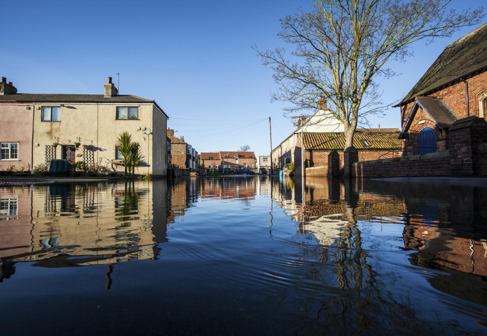
One of the main priorities of the LRF is tidal inundation, with this coming due to Lincolnshire’s position as one of the largest single landmasses in the country that is at risk of the event. Preparations for this event include the use of drones and satellite imagery to identify unknown static caravans, with this informing an improved knowledge of where residents need to be evacuated from should a major flood occur.
Steve Eason-Harris, Lincolnshire County Council’s Emergency Planning Officer, said:
“Responding to large emergencies – particularly flooding but also major transport incidents or the loss of critical infrastructure – is a crucial role of public services. With the climate crisis comes more extreme weather events, which means community resilience is even more important.
“Lincolnshire is a large county with no motorway and few dual carriageways, so response and evacuation planning is critical. These new innovations are enabling emergency planners to model risks affecting the county to maximise response, improve communication and coordination and reduce, as practicably as possible, the impacts on the wider communities of the county. Creating the new caravan dataset in particular will dramatically improve intelligence.”
The development of a workforce application for the deployment, tracking and communication of volunteers that can help support vulnerable people should assistance be required is another way that GIS is being used by the Lincolnshire Resilience Forum.
"Constant innovation is critical at the LRF"
Eason-Harris continued:
“We’re aiming to solve a huge challenge and having the latest geospatial technology means the LRF can respond more effectively. Constant innovation is critical at the LRF, the objective being to use new systems to ensure we get the right resources to the right people at the right time.”
Image credit: iStock | Lincolnshire Resilience Forum